Truck driver following routing app ends up on ATV road, troopers say
Oregon State Police are warning drivers not to trust map routing apps to avoid wildfire-related road closures — and they pointed to one truck driver’s bad day as an example of what could go wrong.
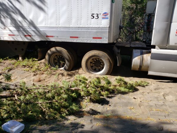
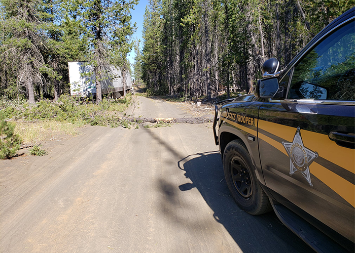
On Thursday morning, Oregon State Police said that a truck driver relying on a map app ran into trouble and became stuck on an ATV road:
We all know that the highway closures from these #Wildfires is very inconvenient; however, it is for your safety.
If you are looking for a safe route to Eastern Oregon, please use www.Tripcheck.com. That is the Oregon Department of Transportation‘s travel information site. You can get 24-7 road conditions, weather information, travel information or view one of hundreds of traffic cameras.
Other direction mapping apps like Google Maps and Waze can be extremely handy when you are traveling along highways you know, but they don’t always know the difference between a highway, streets, forest service road or even an ATV/Snowmobile road.
This truck driver learned the hard way. He was trying to find his way to Eastern Oregon following a map routing app and ended up around the Santiam Pass by taking the Old Santiam Pass Wagon Road, which is an ATV road in the summer and a snowmobile road in the winter. While the OSP Trooper was getting him assistance another sedan also arrived but was safety turned back around.