NWS: Icy storm means “travel could be nearly impossible” in Oklahoma through Thursday evening
A winter storm has rendered Oklahoma travel very treacherous as sleet and ice plagued the roadways overnight.
The icy storm began Wednesday morning, February 23rd, bringing freezing temperatures, ice, and sleet throughout the state that has continued into Thursday.
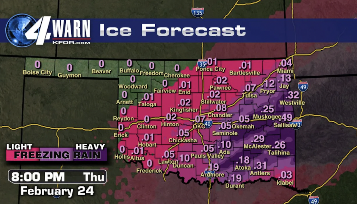
The National Weather Service reports “that areas of light freezing rain and light sleet,” will be “increasing in coverage” throughout Thursday morning. A tenth of an inch of ice is expected to accumulate along Interstate 44 with a quarter inch possible across southeast Oklahoma and northwest Arkansas. Then “the heavier wintry precipitation will shift east of northwest Arkansas by mid to late afternoon.”
“Power outages and tree damage are likely due to the ice,” the report continues.
“Travel could be nearly impossible. The hazardous conditions could impact the… evening commute.”
Oklahoma News 4 called the weather “record breaking cold.”
The effects of these conditions have already been seen during this morning’s commute. Officials say that it has been “a busy 24 hours” as crews respond to multiple motor vehicle accidents and even injuries related to slipping and falling on ice, reported ABC 5 News.
The winter storm warning will remain in effect until 6 p.m. on Thursday evening, February 24th.