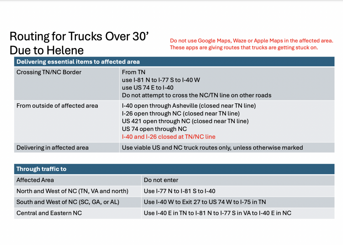
North Carolina DOT shares official Hurricane Helene routing for trucks over 30 feet
The North Carolina Department of Transportation (NCDOT) shared official routing information for truckers trying to deliver goods in the wake of a major hurricane.
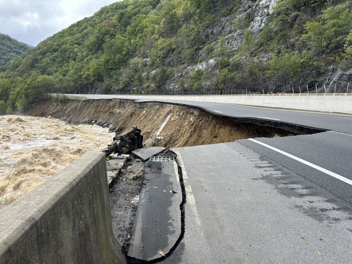
September’s devastating Hurricane Helene did major damage to a number of roadways, including I-40 and I-26 at the North Carolina and Tennessee border.
NCDOT recently shared official Hurricane Helene routing information specifically for the trucking community.
Officials are asking truckers to use this routing information instead of Google Maps, Waze or Apple Maps in the affected areas because “these apps are giving routes that trucks are getting stuck on.”
See below for details.
NCDOT Routing for Trucks Over 30’ Due to Helene